
Welcome to the Canadian Watershed Information Network (CanWIN)
Mobilizing science for evidence based decision making.
CanWIN is the data centre for the Centre for Earth Observation Science (CEOS). We support research and education, and inform management, policy and evidence based decision-making from the Nelson River Watershed to the Arctic.
Quick links
135-Year Old Code Mystery Highlights Forgotten Era of Meteorology
Canadian researcher cracks 135 year old "unsolvable" code
View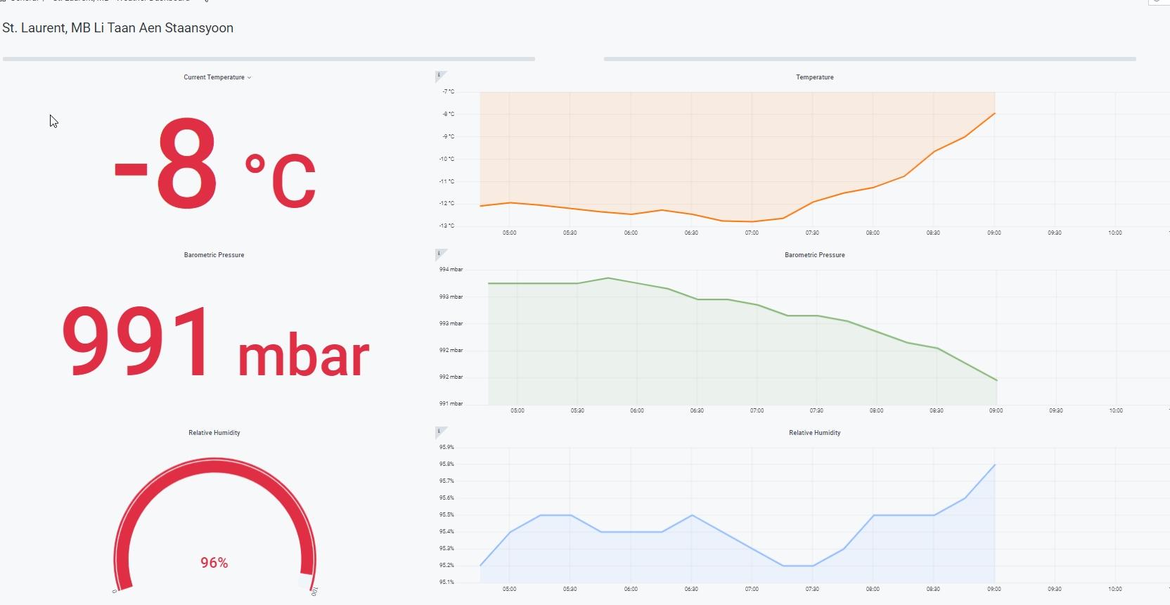
St. Laurent Li Taan Aen Staansyoon
View near-real time weather data from St.Laurent, MB in a straightforward dashboard format.
View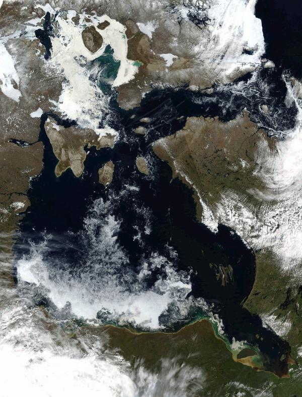
CanWIN GeoPortal
A geospatial data exploration tool providing tools for users to create, view and share maps.
View
CanWIN ERDDAP Server
Advanced users can use the power of ERDDAP to view, subset, graph & download data.
ViewSearch spatially for data
Featured projects and datasets
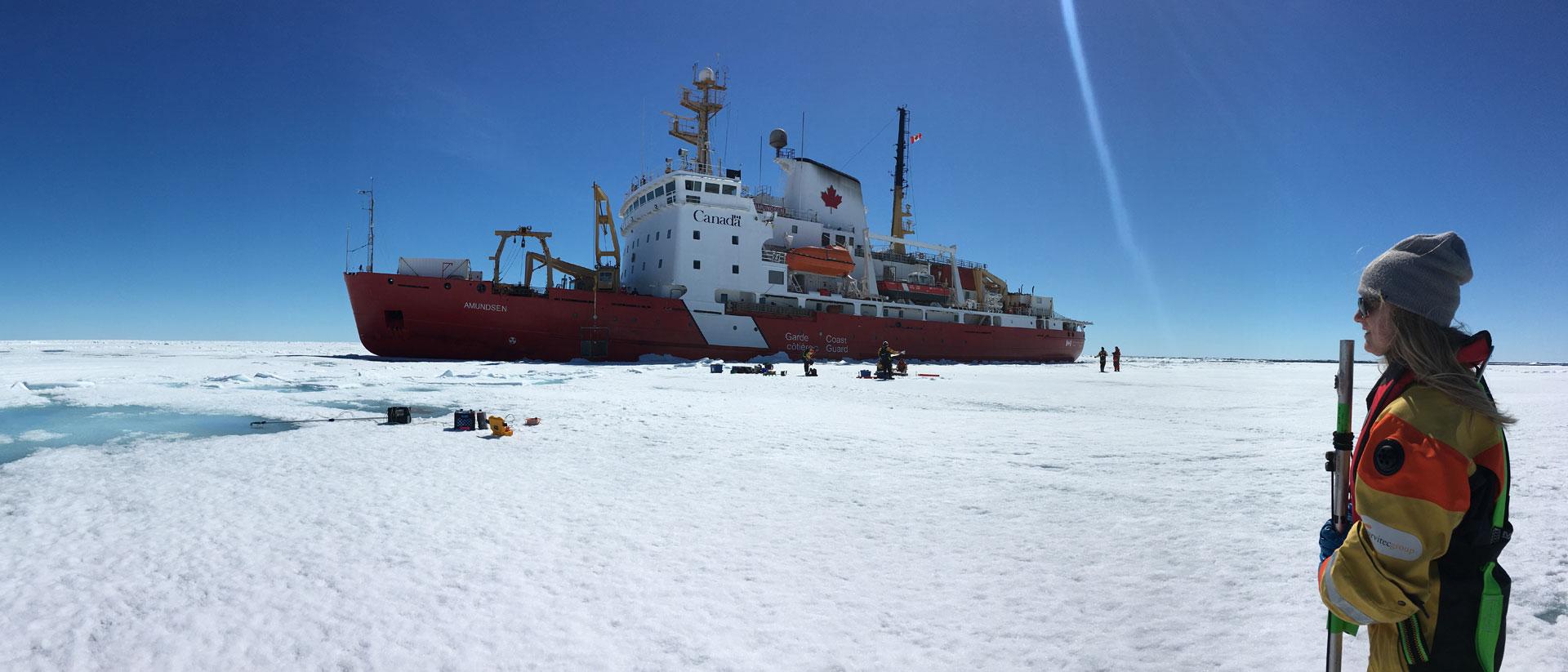
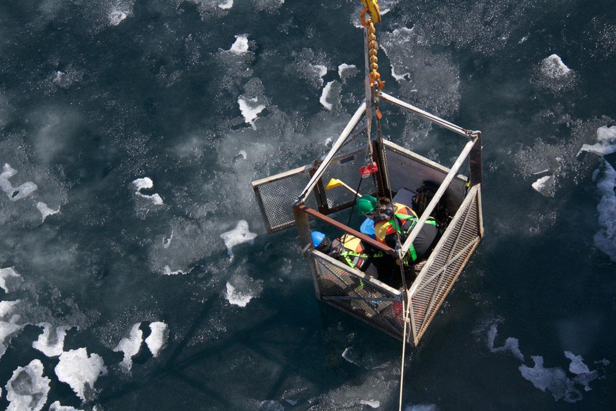
Hudson Bay System Study (BaySys)
Themes: Cryosphere, Freshwater, Marine, Remote Sensing
Freshwater-marine coupling affects all aspects of the physical, biological and biogeochemical systems within Hudson Bay. The past century has seen si... Read more
Oct 12, 2021
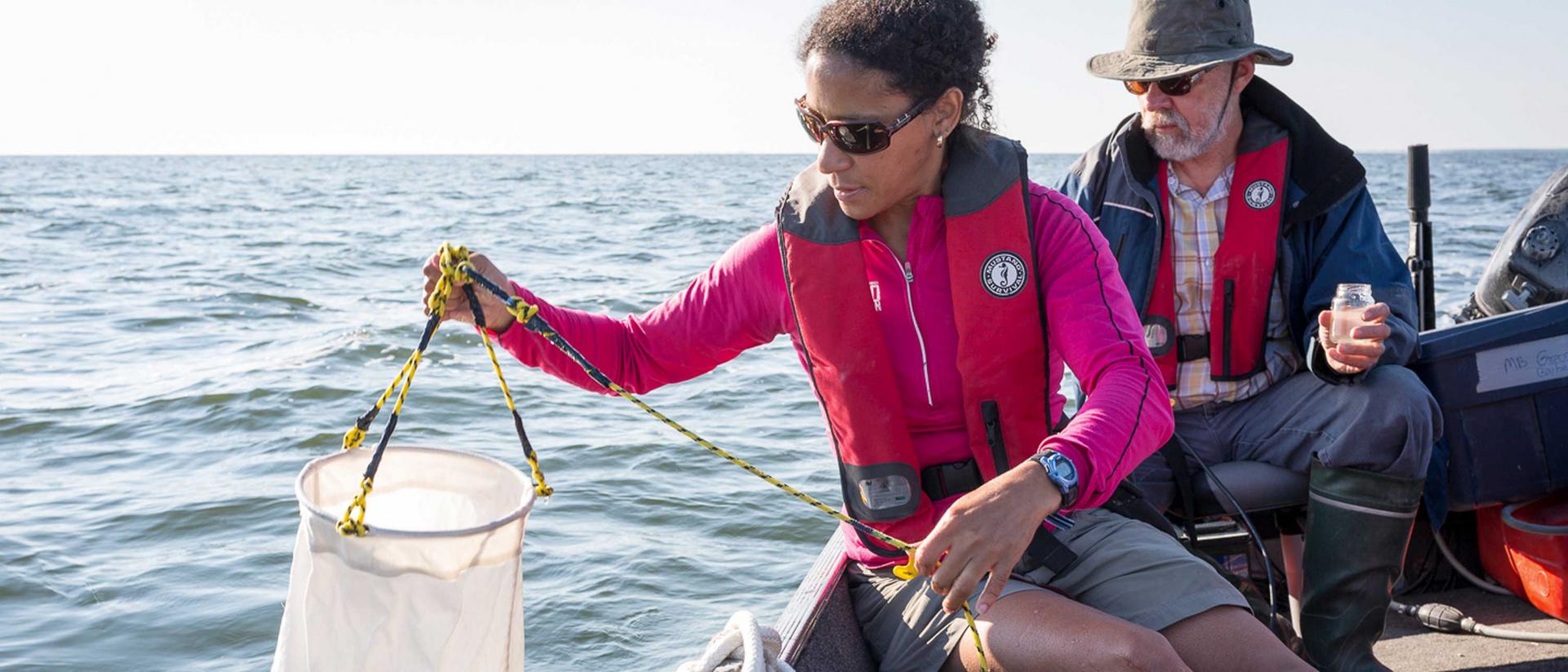
The Manitoba Great Lakes Program
Themes: Atmosphere, Freshwater, Remote Sensing
The Manitoba Great Lakes (MBGL) program is led by researchers at the Centre for Earth Observation Science (CEOS) at the University of Manitoba, and is... Read more
Jul 26, 2021
Northern Hemisphere Extratropical Cyclone Tracks from ERA-5
Theme: Atmosphere, Cryosphere
This dataset comprises a series of CSV files, each of which catalogues a suite of information for an individual cyclone track for the Northern Hemisph... Read more
Oct 13, 2020
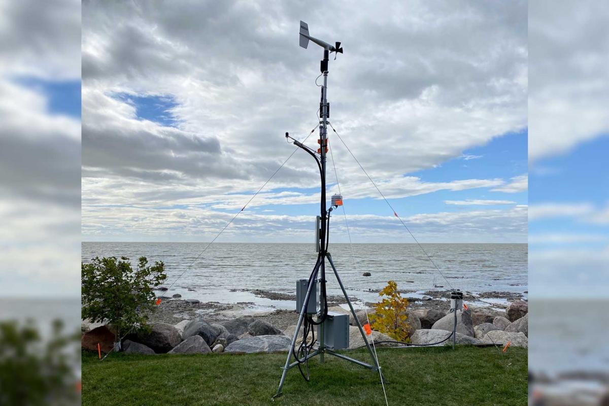
St Laurent Li Taan Aen Staansyoon_17060
Theme: Atmosphere, Freshwater
This dataset consists of data and supplemental materials related to the weather station located in St. Laurent, MB on the eastern shore of Lake Manito... Read more
Dec 16, 2022
Sea-ice edge phytoplankton bloom
Theme: Cryosphere, Marine
Satellite-derived sea-ice retreat timing (tR) and maximum chlorophyll-a concentration in the ice edge zone between 1998 and 2018. Sea ice concentratio... Read more
Feb 04, 2021
Funding and partners